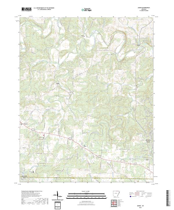
2024 Map of Agnos
USGS Topo · Published 2024About this map
Agnos and Glencoe serve as central points in this landscape where the borders of Fulton, Izard, and Sharp counties meet. The topography is defined by the winding course of the South Fork Spring River in the northeast and a network of named drainages like Wild Horse Creek and Lick Creek. These watercourses dictated the placement of small communities such as Saddle and Heart, which are connected by a web of rural routes including French Town Rd and Possum Trot Rd. Local genealogy is anchored by the Rhoads Cem near Glencoe and the Humphries Cem further south. The map illustrates a shift in land use toward the southeast corner, where the planned residential layouts of Cherokee Village and Horseshoe Bend introduce a more modern development pattern near Timber Lake, contrasting with the more traditional rural settlement clusters found at French and Kittle.
Find a feature on this map
107 named features on this map. Tap any name to fly to it.
Don’t see what you’re looking for? This feature index may not catch every label — zoom into the map to look around manually.
Map Details
Editions of this 2024 Agnos Map
This is the sole edition of this map. No revisions or reprints were ever made.
Other maps of this area

1950 · Salem
USGS Topo · 1:62,500

1951 · Salem
USGS Topo · 1:62,500

1951 · Melbourne
USGS Topo · 1:62,500

1957 · Poplar Bluff
USGS Topo · 1:250,000

1959 · Poplar Bluff
USGS Topo · 1:250,000

1960 · Poplar Bluff
USGS Topo · 1:250,000

1962 · Stuart
USGS Topo · 1:24,000

1962 · Ash Flat
USGS Topo · 1:24,000

1962 · Myron
USGS Topo · 1:24,000

1962 · Agnos
USGS Topo · 1:24,000