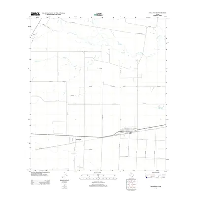
2013 Map of Agua Dulce
USGS Topo · Published 2013About this map
Agua Dulce and the nearby settlement of Bentonville occupy this South Texas landscape where the coastal plains are defined by an intricate network of intermittent creek beds. The drainage pattern of Palo Hueco Cr and Rosita Cr indicates a terrain shaped by seasonal water flow, while Aqua Dulce Cr meanders toward the northeast.
Find a feature on this map
51 named features on this map. Tap any name to fly to it.
Don’t see what you’re looking for? This feature index may not catch every label — zoom into the map to look around manually.
Map Details
Editions of this 2013 Agua Dulce Map
This is the sole edition of this map. No revisions or reprints were ever made.
Other maps of this area

1917 · Ben Bolt
USGS Topo · 1:62,500

1920 · San Diego
USGS Topo · 1:62,500

1950 · Corpus Christi
USGS Topo · 1:250,000

1954 · Orange Grove
USGS Topo · 1:62,500

1954 · Kingsville
USGS Topo · 1:62,500

1956 · Corpus Christi
USGS Topo · 1:250,000

1956 · Laredo
USGS Topo · 1:250,000

1960 · Corpus Christi
USGS Topo · 1:250,000

1963 · San Diego NE
USGS Topo · 1:24,000
1963 · Alice North
USGS Topo · 1:24,000
Featured Places
- Agua Dulce, TX
- Bentonville, TX
- Harvest Acres Colonia, TX
- Palo Hueco Estates Colonia, TX
- Nueces County, TX