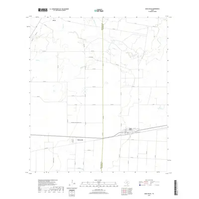
2019 Map of Agua Dulce
USGS Topo · Published 2019About this map
Agua Dulce serves as the primary hub of this South Texas landscape, where the grid-like street patterns of the town center contrast with the expansive ranching and agricultural lands of Nueces and Jim Wells counties. The settlement is centered around a local Po and is flanked by smaller communities like Bentonville to the west. This map illustrates a transition from the structured residential blocks of the town to the wide-open terrain of the coastal plain, marked by drainage features such as Tecolote Cr. The rural character of the area is further defined by the scattered settlement at Alfred, indicating a region long shaped by farming and regional transit routes connecting these outlying communities.
Find a feature on this map
5 named features on this map. Tap any name to fly to it.
Don’t see what you’re looking for? This feature index may not catch every label — zoom into the map to look around manually.
Map Details
Editions of this 2019 Agua Dulce Map
This is the sole edition of this map. No revisions or reprints were ever made.
Other maps of this area

1917 · Ben Bolt
USGS Topo · 1:62,500

1920 · San Diego
USGS Topo · 1:62,500

1950 · Corpus Christi
USGS Topo · 1:250,000

1954 · Orange Grove
USGS Topo · 1:62,500

1954 · Kingsville
USGS Topo · 1:62,500

1956 · Corpus Christi
USGS Topo · 1:250,000

1956 · Laredo
USGS Topo · 1:250,000

1960 · Corpus Christi
USGS Topo · 1:250,000

1963 · San Diego NE
USGS Topo · 1:24,000
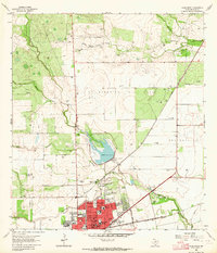
1963 · Alice North
USGS Topo · 1:24,000
Featured Places
- Agua Dulce, TX
- Bentonville, TX
- Harvest Acres Colonia, TX
- Palo Hueco Estates Colonia, TX
- Nueces County, TX