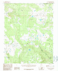
1987 Map of Agua Fria Peak
USGS Topo · Published 1987About this map
The high northern New Mexico terrain of the Beaubien and Miranda (Maxwell) land grant dominates this 1980s landscape, where elevations crest at Agua Fria Peak. The northeastern corner of the map includes a portion of the Philmont Scout Ranch, a site of significant cultural and recreational importance in Colfax County. The hydrology of the area is defined by numerous drainage systems and high-country water bodies, including Cieneguilla Creek, which winds through the Valley of the Utes, and the headwaters of Wheaten Creek. Topographical landmarks like Spruce Hill, Salt House Ridge, and Willys Tip provide specific points of orientation within this complex geography. Along the southern boundary near the Mora line, the map details the expansive Ocate Mesa and the distinctively named Laguna Salada. This survey documents the area's transition from the cattle-range legacy of the Maxwell Grant to its modern identification with outdoor scouting and conservation.
Find a feature on this map
26 named features on this map. Tap any name to fly to it.
Don’t see what you’re looking for? This feature index may not catch every label — zoom into the map to look around manually.
Map Details
Editions of this 1987 Agua Fria Peak Map
This is the sole edition of this map. No revisions or reprints were ever made.
Other maps of this area

1954 · Raton
USGS Topo · 1:250,000

1956 · Tooth Of Time
USGS Topo · 1:62,500

1958 · Raton
USGS Topo · 1:250,000

1965 · Osha Mountain
USGS Topo · 1:24,000

1965 · Chacon
USGS Topo · 1:24,000

1965 · Palo Flechado Pass
USGS Topo · 1:24,000

1966 · Guadalupita
USGS Topo · 1:24,000

1966 · Ocate
USGS Topo · 1:24,000

1983 · Taos
USGS Topo · 1:100,000
1987 · White Peak
USGS Topo · 1:24,000