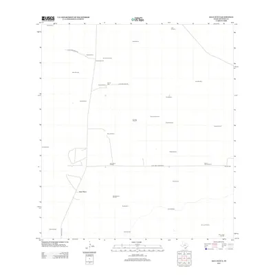
2012 Map of Agua Nueva
USGS Topo · Published 2012About this map
Agua Nueva and the surrounding ranchlands of Jim Hogg County are defined by a network of water-sourcing windmills essential to this arid South Texas landscape. In the early 21st century, the map reveals a remote, low-density settlement pattern centered on private landholdings like Palomas Ranch. Long gravel and paved routes, including Ranch Road 1017 and Las Palomas Ranch Rd, connect isolated homesteads and livestock operations. For genealogists and local historians, the presence of the Ramirez Cem near La Salada Ranch Rd provides a specific point of familial significance within the ranching community. The sheer density of named water features, such as Arroyo Windmill, Tres Lagunas Windmill, and Buena Suerte Windmill, underscores the constant necessity of managing water for cattle in a region without significant natural surface water.
Find a feature on this map
35 named features on this map. Tap any name to fly to it.
Don’t see what you’re looking for? This feature index may not catch every label — zoom into the map to look around manually.
Map Details
Editions of this 2012 Agua Nueva Map
This is the sole edition of this map. No revisions or reprints were ever made.
Other maps of this area

1921 · Falfurrias
USGS Topo · 1:125,000

1938 · Agua Nueva
USGS Topo · 1:62,500

1939 · Encantada
USGS Topo · 1:62,500

1949 · Mc Allen
USGS Topo · 1:250,000

1954 · McAllen
USGS Topo · 1:250,000

1956 · Laredo
USGS Topo · 1:250,000

1957 · Mc Allen
USGS Topo · 1:250,000

1962 · McAllen
USGS Topo · 1:250,000

1968 · Palomas Ranch SW
USGS Topo · 1:24,000
1972 · Alta Vista Ranch SW
USGS Topo · 1:24,000