
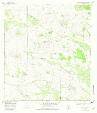
1968 Map of Palomas Ranch SW
USGS Topo · Published 1971About this map
The boundary line between Jim Hogg Co and Brooks Co bisects this late 1960s landscape, revealing a ranching economy defined by its water infrastructure. The terrain is dotted with numerous family-named landmarks and water sources, such as the Agua Nueva Windmill, Blanco Windmill, and La Javalina Windmill. Unlike typical dry-well areas, this region includes rare artesian features like the Rayado Well (Flowing) and Lindero Well (Flowing), indicating high-pressure groundwater essential for the remote cattle operations of the day. In the northern reaches, the small settlement of Garcia sits near a network of trails, while a solitary Gravel Pit suggests localized resource extraction to support the maintenance of the extensive road and fence networks that crisscross the sandy brush country.
Find a feature on this map
26 named features on this map. Tap any name to fly to it.
Don’t see what you’re looking for? This feature index may not catch every label — zoom into the map to look around manually.
Map Details
Editions of this 1968 Palomas Ranch SW Map
2 editions found
Other maps of this area

1921 · Falfurrias
USGS Topo · 1:125,000

1938 · Agua Nueva
USGS Topo · 1:62,500

1939 · Encantada
USGS Topo · 1:62,500

1949 · Mc Allen
USGS Topo · 1:250,000

1954 · McAllen
USGS Topo · 1:250,000

1956 · Laredo
USGS Topo · 1:250,000

1957 · Mc Allen
USGS Topo · 1:250,000

1962 · McAllen
USGS Topo · 1:250,000

1968 · Palomas Ranch NW
USGS Topo · 1:24,000

1968 · Palomas Ranch SE
USGS Topo · 1:24,000