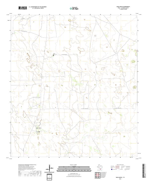
2022 Map of Agua Nueva
USGS Topo · Published 2022About this map
Agua Nueva sits at the heart of this South Texas landscape, where family heritage is anchored by quiet landmarks like Lazaro Ramirez Cem and Ramirez Cem. The topography of Jim Hogg County is defined here by a network of ranch roads and remote homestead identifiers that reflect the region's enduring cattle-ranching traditions. Long stretches of road like Alice Jones Thompson Rd and La Salada Ranch Rd cross the terrain, connecting isolated headquarters and properties. The influence of state infrastructure is visible via FM 1017, which serves as a primary artery through this sparsely populated ranching country. For genealogists and local historians, these specific family-named cemeteries and ranch roads provide concrete points of connection to the long-standing land-use patterns of the South Texas brush country.
Find a feature on this map
9 named features on this map. Tap any name to fly to it.
Don’t see what you’re looking for? This feature index may not catch every label — zoom into the map to look around manually.
Map Details
Editions of this 2022 Agua Nueva Map
This is the sole edition of this map. No revisions or reprints were ever made.
Other maps of this area

1921 · Falfurrias
USGS Topo · 1:125,000

1938 · Agua Nueva
USGS Topo · 1:62,500

1939 · Encantada
USGS Topo · 1:62,500

1949 · Mc Allen
USGS Topo · 1:250,000

1954 · McAllen
USGS Topo · 1:250,000

1956 · Laredo
USGS Topo · 1:250,000

1957 · Mc Allen
USGS Topo · 1:250,000

1962 · McAllen
USGS Topo · 1:250,000

1968 · Palomas Ranch SW
USGS Topo · 1:24,000
1972 · Alta Vista Ranch SW
USGS Topo · 1:24,000