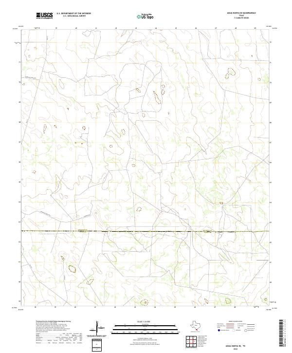
2022 Map of Agua Nueva SE
USGS Topo · Published 2022About this map
The boundary between Jim Hogg Co and Starr Co bisects this South Texas landscape, documenting the contemporary ranching infrastructure and rural road networks of the brush country. The topography is largely defined by the movement of local traffic along FM 1017 and a series of family-named ranch access roads that intersect the county line. The presence of Borregos Ranch Rd and Ramirito Ranch Rd indicates the enduring legacy of private landholdings in this region, where large parcels remain divided by minimal surveying lines rather than dense settlement. Aside from the small thoroughfare of Jonquil, the map depicts a sparsely populated area where the primary human footprint is found in the cattle pens, wind pumps, and dirt tracks typical of the Rio Grande Plain.
Find a feature on this map
6 named features on this map. Tap any name to fly to it.
Don’t see what you’re looking for? This feature index may not catch every label — zoom into the map to look around manually.
Map Details
Editions of this 2022 Agua Nueva SE Map
This is the sole edition of this map. No revisions or reprints were ever made.
Other maps of this area

1938 · Agua Nueva
USGS Topo · 1:62,500

1938 · Sal Colorada
USGS Topo · 1:62,500

1939 · La Reforma
USGS Topo · 1:62,500

1939 · Encantada
USGS Topo · 1:62,500

1949 · Mc Allen
USGS Topo · 1:250,000

1954 · McAllen
USGS Topo · 1:250,000

1957 · Mc Allen
USGS Topo · 1:250,000

1962 · McAllen
USGS Topo · 1:250,000
1972 · San Isidro
USGS Topo · 1:24,000
1972 · Santa Elena NW
USGS Topo · 1:24,000