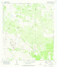
1972 Map of Santa Elena NW
USGS Topo · Published 1975About this map
Hydrological infrastructure dominates this South Texas landscape, where life and livestock depended on a network of named wells and windmills in the early 1970s. The border between Jim Hogg Co and Brooks Co bisects the terrain, which is primarily characterized by rangeland and brush-country management. Names like Bonita Well and Alto Bonito Well indicate artesian water sources, while the proliferation of windmills such as Posita Windmill, Mama Windmill, and El Jardin Windmill reveal the localized nature of ranching operations.
Find a feature on this map
27 named features on this map. Tap any name to fly to it.
Don’t see what you’re looking for? This feature index may not catch every label — zoom into the map to look around manually.
Map Details
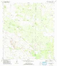
Editions of this 1972 Santa Elena NW Map
2 editions found
Other maps of this area

1921 · Falfurrias
USGS Topo · 1:125,000

1938 · Agua Nueva
USGS Topo · 1:62,500

1939 · Encantada
USGS Topo · 1:62,500

1949 · Mc Allen
USGS Topo · 1:250,000

1954 · McAllen
USGS Topo · 1:250,000

1956 · Laredo
USGS Topo · 1:250,000

1957 · Mc Allen
USGS Topo · 1:250,000

1962 · McAllen
USGS Topo · 1:250,000

1968 · Palomas Ranch SW
USGS Topo · 1:24,000

1968 · Palomas Ranch SE
USGS Topo · 1:24,000