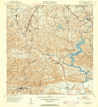
1952 Map of Aguas Buenas
USGS Topo · Published 1953About this map
Aguas Buenas and its surrounding mountain barrios are shown here as they appeared in the early 1950s, a period of transition before the heavy urban expansion of the late twentieth century. The map details a complex landscape of steep ridges and deep valleys, anchored by the Río Grande de Loíza which winds through the eastern sectors of La Gloria and Jaguas. Evidence of the era's social and communication infrastructure is visible through the Antena de Radio (WAPA) near Guaynabo and several rural educational centers like the Escuela Segunda Unidad de Río Cañas. The rugged interior topography is marked by named peaks such as Cerro Marquesa and Altos de la Mesa, while the settlement pattern remains largely clustered around traditional centers like Pueblo Seco and Bocas. This survey captures the mid-century municipal boundaries and local landmarks, including the Planta Alcantarillado and the specialized facility at Leprocomio.
Find a feature on this map
80 named features on this map. Tap any name to fly to it.
Don’t see what you’re looking for? This feature index may not catch every label — zoom into the map to look around manually.
Map Details
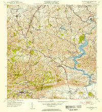
Editions of this 1952 Aguas Buenas Map
2 editions found
Other maps of this area

1940 · Carolina
USGS Topo · 1:30,000

1941 · Bayamon
USGS Topo · 1:30,000

1941 · San Juan
USGS Topo · 1:30,000

1941 · Carolina
USGS Topo · 1:30,000

1946 · Aguas Buenas
USGS Topo · 1:30,000

1946 · Comerio
USGS Topo · 1:30,000

1946 · Naranjito
USGS Topo · 1:30,000

1946 · Gurabo
USGS Topo · 1:30,000

1946 · Juncos
USGS Topo · 1:30,000

1946 · Caguas
USGS Topo · 1:30,000