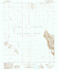
1990 Map of Aguila Mountains NW
USGS Topo · Published 1990About this map
Barry M Goldwater Air Force Range dominates this landscape in Yuma County, illustrating the massive scale of military land use in the Arizona desert during the late twentieth century. The terrain is characterized by the stark contrast between the steep, jagged Aguila Mountains in the east and the broad, sweeping San Cristobal Valley to the west. Evidence of the active environment is seen in the shifting Sand Dunes near the valley floor, while the Aztec Hills rise to the north. This 1990 provisional edition, based on earlier surveys and 1980s aerial photography, captures a region primarily defined by its physical geography and military boundaries, where sparse 4wd tracks provide the only established passage through the arid basin.
Find a feature on this map
10 named features on this map. Tap any name to fly to it.
Don’t see what you’re looking for? This feature index may not catch every label — zoom into the map to look around manually.
Map Details
Editions of this 1990 Aguila Mountains NW Map
This is the sole edition of this map. No revisions or reprints were ever made.
Other maps of this area

1927 · Aguila Mountains
USGS Topo · 1:48,000

1927 · Kim
USGS Topo · 1:62,500

1929 · Aztec
USGS Topo · 1:62,500

1930 · Aguila Mountains
USGS Topo · 1:62,500

1930 · Stoval
USGS Topo · 1:62,500

1931 · Kim
USGS Topo · 1:62,500

1950 · Stoval
USGS Topo · 1:62,500

1950 · Aztec
USGS Topo · 1:62,500

1953 · Ajo
USGS Topo · 1:250,000

1957 · Ajo
USGS Topo · 1:250,000