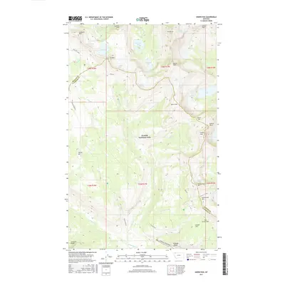
2017 Map of Ahern Pass
USGS Topo · Published 2017About this map
Glacier National Park dominates this high-altitude survey of the Northern Rockies, where the Continental Divide traces a jagged path across the Livingston Range. The map documents a landscape of dramatic verticality, defined by the towering arête of The Garden Wall and the precarious route of the Highline trail. Hydrological features are abundant, from the remote waters of Sue Lake and Helen Lake to the cascading Atsina Falls and Ipasha Falls. This 2017 study captures the status of several significant ice masses, including the Shepard Glacier, Ahern Glacier, and Old Sun Glacier, providing a benchmark for these receding features. Notable transit points like Ahern Pass and Swiftcurrent Pass mark the traditional crossings through this wilderness, while the engineering of the Going-to-the-Sun Road skirts the southern edge near Crystal Point.
Find a feature on this map
55 named features on this map. Tap any name to fly to it.
Don’t see what you’re looking for? This feature index may not catch every label — zoom into the map to look around manually.
Map Details
Editions of this 2017 Ahern Pass Map
This is the sole edition of this map. No revisions or reprints were ever made.
Other maps of this area

1904 · Chief Mountain
USGS Topo · 1:125,000

1938 · Chief Mountain
USGS Topo · 1:125,000

1960 · Cut Bank
USGS Topo · 1:250,000

1963 · Cut Bank
USGS Topo · 1:250,000

1964 · Cut Bank
USGS Topo · 1:250,000

1968 · Ahern Pass
USGS Topo · 1:24,000
1968 · Mount Cannon
USGS Topo · 1:24,000

1968 · Gable Mountain
USGS Topo · 1:24,000
1968 · Camas Ridge East
USGS Topo · 1:24,000
1968 · Porcupine Ridge
USGS Topo · 1:24,000