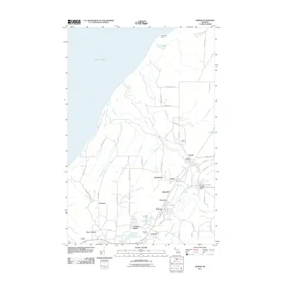
2011 Map of Ahmeek
USGS Topo · Published 2011About this map
Ahmeek and Copper City anchor this portion of the Keweenaw Peninsula, revealing a landscape shaped by the historic copper mining industry and residential clusters that formed around the shafts. The grid-like patterns of Centennial Heights and Wolverine reflect the organized company towns of the era, while the density of named locales like Bumbletown, Phillipsville, and Kearsarge illustrates the once-bustling nature of this northern Michigan mining district. To the west, the shoreline of Lake Superior meets Sevenmile Point, while inland drainage systems such as Gratiot River and Slaughterhouse Creek carve through the terrain.
Find a feature on this map
64 named features on this map. Tap any name to fly to it.
Don’t see what you’re looking for? This feature index may not catch every label — zoom into the map to look around manually.
Map Details
Editions of this 2011 Ahmeek Map
This is the sole edition of this map. No revisions or reprints were ever made.
Other maps of this area

1915 · Houghton
USGS Topo · 1:62,500

1941 · Ahmeek
USGS Topo · 1:31,680

1941 · Mohawk
USGS Topo · 1:31,680

1946 · Phoenix
USGS Topo · 1:24,000

1946 · Hancock
USGS Topo · 1:24,000

1946 · Mohawk
USGS Topo · 1:24,000

1946 · Muggun Creek
USGS Topo · 1:24,000

1946 · Ahmeek
USGS Topo · 1:24,000

1946 · Laurium
USGS Topo · 1:24,000

1947 · Phoenix
USGS Topo · 1:24,000