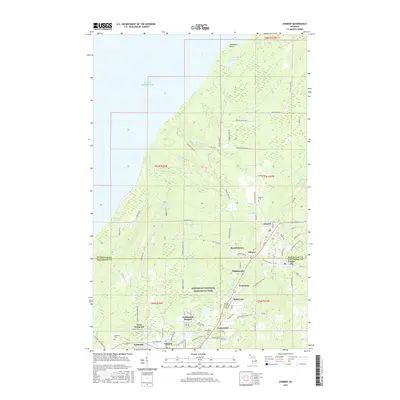
2017 Map of Ahmeek
USGS Topo · Published 2017About this map
Keweenaw National Historical Park preserves the deep legacy of Michigan's copper country on this northern peninsula. The landscape is defined by the transition from the rocky shores of Lake Superior at Sevenmile Point to the elevated industrial and residential clusters of the Keweenaw Ridge. A dense network of local roads such as Kezele Farm Rd and Farmers Block Rd serves the rural outskirts, while the central corridor is anchored by established mining-era settlements like Ahmeek, Allouez, and Centennial Heights.
Find a feature on this map
82 named features on this map. Tap any name to fly to it.
Don’t see what you’re looking for? This feature index may not catch every label — zoom into the map to look around manually.
Map Details
Editions of this 2017 Ahmeek Map
This is the sole edition of this map. No revisions or reprints were ever made.
Other maps of this area

1915 · Houghton
USGS Topo · 1:62,500

1941 · Ahmeek
USGS Topo · 1:31,680

1941 · Mohawk
USGS Topo · 1:31,680

1946 · Phoenix
USGS Topo · 1:24,000

1946 · Hancock
USGS Topo · 1:24,000

1946 · Mohawk
USGS Topo · 1:24,000

1946 · Muggun Creek
USGS Topo · 1:24,000

1946 · Ahmeek
USGS Topo · 1:24,000

1946 · Laurium
USGS Topo · 1:24,000

1947 · Phoenix
USGS Topo · 1:24,000