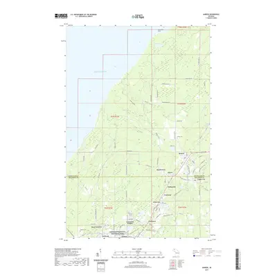
2019 Map of Ahmeek
USGS Topo · Published 2019About this map
The Keweenaw National Historical Park anchors the southern portion of this map, preserving the industrial legacy of Michigan's Copper Country. A dense network of mining-era settlements, including Ahmeek, Bumbletown, Centennial, and Wolverine, follows the mineral-rich geological ridge. This 2019 survey shows the transition from these high-density residential hubs to the forested shoreline of Lake Superior at Sevenmile Point. The map provides significant detail for genealogists, with three distinct burial grounds—Ahmeek Cem, Lakeview Cem, and Schoolcraft Cem—located near the historical village centers. Inland, the Keweenaw State Trail follows old rail corridors through Copper City and Kearsarge, while the Gratiot River flows through the northern woodlands toward the lake.
Find a feature on this map
79 named features on this map. Tap any name to fly to it.
Don’t see what you’re looking for? This feature index may not catch every label — zoom into the map to look around manually.
Map Details
Editions of this 2019 Ahmeek Map
This is the sole edition of this map. No revisions or reprints were ever made.
Other maps of this area

1915 · Houghton
USGS Topo · 1:62,500

1941 · Ahmeek
USGS Topo · 1:31,680

1941 · Mohawk
USGS Topo · 1:31,680

1946 · Phoenix
USGS Topo · 1:24,000

1946 · Hancock
USGS Topo · 1:24,000

1946 · Mohawk
USGS Topo · 1:24,000

1946 · Muggun Creek
USGS Topo · 1:24,000

1946 · Ahmeek
USGS Topo · 1:24,000

1946 · Laurium
USGS Topo · 1:24,000

1947 · Phoenix
USGS Topo · 1:24,000