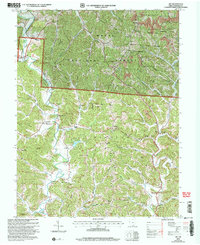
2002 Map of Aid
USGS Topo · Published 2006About this map
Symmes Creek carves a deep valley through this portion of the Wayne National Forest, defining a landscape of narrow ridges and hollows in southern Ohio. The 2002 revision shows the persistence of small upland settlements like Willow Wood, Venisonham, and Dobbston, many of which grew around country churches and township schools. The eastern edge of the map features the Crown City Wilderness Area, while the terrain to the north around Rapp Rapp and Lawrence Chapel is marked by the presence of Strip Mines, indicating the region's industrial ties to coal extraction. This survey serves as a detailed record of rural social infrastructure, preserving the locations of numerous community landmarks including New Zion Ch, Locust Grove Ch, and Township Sch No 1, which often remain the primary touchstones for local history and genealogy in these wooded hills.
Find a feature on this map
78 named features on this map. Tap any name to fly to it.
Don’t see what you’re looking for? This feature index may not catch every label — zoom into the map to look around manually.
Map Details
Editions of this 2002 Aid Map
This is the sole edition of this map. No revisions or reprints were ever made.
Other maps of this area

1892 · Huntington
USGS Topo · 1:125,000

1898 · Huntington
USGS Topo · 1:125,000

1898 · Ironton
USGS Topo · 1:62,500

1900 · Ironton
USGS Topo · 1:62,500

1901 · Guyandot
USGS Topo · 1:62,500

1901 · Ceredo
USGS Topo · 1:62,500

1902 · Guyandot
USGS Topo · 1:62,500

1903 · Kenova
USGS Topo · 1:125,000

1904 · Kenova
USGS Topo · 1:125,000

1906 · Athalia
USGS Topo · 1:62,500