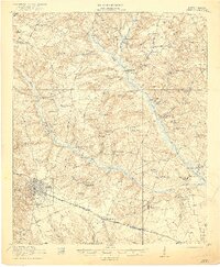
1921 Map of Aiken
USGS Topo · Published 1921About this map
Aiken sits at a critical junction of the Southern Railway and the Charleston and Western Carolina Railway, serving as a central hub for this portion of South Carolina. The surrounding landscape is characterized by a dense network of educational and spiritual centers, such as Fountain Academy and Welcome Traveler Church, which reflect the social fabric of rural communities at the start of the 1920s.
Find a feature on this map
75 named features on this map. Tap any name to fly to it.
Don’t see what you’re looking for? This feature index may not catch every label — zoom into the map to look around manually.
Map Details
Editions of this 1921 Aiken Map
3 editions found
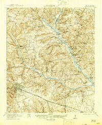
Other maps of this area

1920 · Aiken
USGS Topo · 1:48,000

1920 · Talatha
USGS Topo · 1:48,000

1921 · Augusta
USGS Topo · 1:62,500

1921 · Aiken
USGS Topo · 1:62,500

1921 · Talatha
USGS Topo · 1:62,500

1923 · Williston
USGS Topo · 1:48,000

1923 · Warrenville
USGS Topo · 1:48,000

1927 · Williston
USGS Topo · 1:62,500

1928 · Warrenville
USGS Topo · 1:62,500

1943 · Aiken
USGS Topo · 1:62,500