
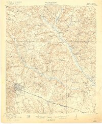
1921 Map of Aiken
USGS Topo · Published 1921About this map
The street grid of Aiken stands as a focal point in this early twentieth-century survey, surrounded by a dense network of rural infrastructure defined by numerous country schools and churches. This era shows a landscape transitioned from frontier to a structured agricultural and industrial society, anchored by the Southern Railway as it passes through Montmorenci and Oakwood. The geography is defined by the winding paths of Shaw Creek and Cedar Creek, which supported local industry at sites like Livingstons Mill and public utilities such as the Aiken Water Works.
Find a feature on this map
76 named features on this map. Tap any name to fly to it.
Don’t see what you’re looking for? This feature index may not catch every label — zoom into the map to look around manually.
Map Details
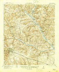
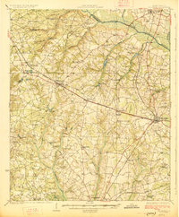
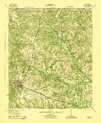
Editions of this 1921 Aiken Map
3 editions found
Other maps of this area

1920 · Aiken
USGS Topo · 1:48,000

1920 · Talatha
USGS Topo · 1:48,000

1921 · Augusta
USGS Topo · 1:62,500

1921 · Talatha
USGS Topo · 1:62,500

1923 · Williston
USGS Topo · 1:48,000

1923 · Warrenville
USGS Topo · 1:48,000
1927 · Williston
USGS Topo · 1:62,500

1928 · Warrenville
USGS Topo · 1:62,500
1943 · Aiken
USGS Topo · 1:62,500

1943 · Augusta East
USGS Topo · 1:125,000