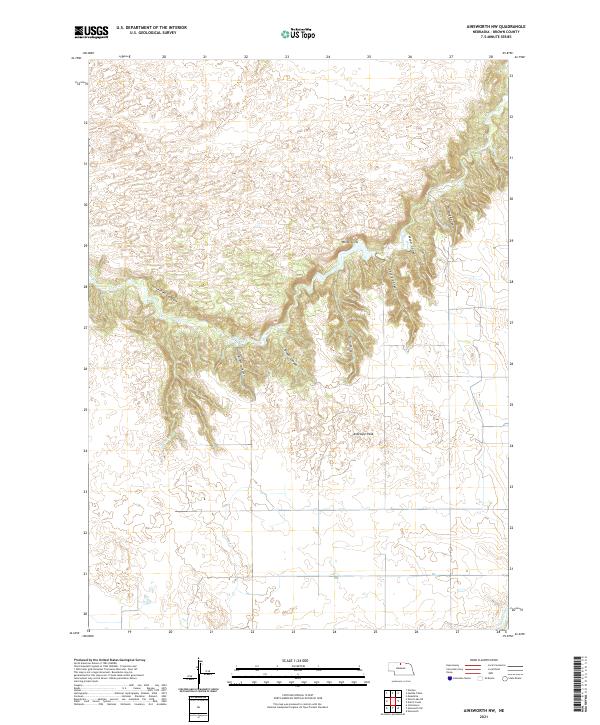
2021 Map of Ainsworth NW
USGS Topo · Published 2021About this map
Antelope Peak stands as a prominent landmark in this section of Brown County, overlooking a complex network of eroded drainages and deep coulees. The landscape is defined by the sharp descent from the southern plains into the broken terrain of the Niobrara River valley outskirts, where features like White Cliffs and Horsethief Canyons reveal the underlying geology. Named drainages such as Bill White Canyon, Broyer Canyon, and Lessig Canyon cut through the elevation, carrying seasonal runoff toward the perennial waters of Plum Cr. The map details the transition from high-altitude tablelands to the dissected breaks, showing a territory primarily shaped by water erosion and ranching access. While few structures are named, the presence of specific family-named landmarks like Hurlbut Canyon and Wood Canyon provides a topographic baseline for local land ownership and historical land use patterns.
Find a feature on this map
16 named features on this map. Tap any name to fly to it.
Don’t see what you’re looking for? This feature index may not catch every label — zoom into the map to look around manually.
Map Details
Editions of this 2021 Ainsworth NW Map
This is the sole edition of this map. No revisions or reprints were ever made.
Other maps of this area

1949 · Dutch Creek
USGS Topo · 1:24,000

1950 · Norden
USGS Topo · 1:62,500

1950 · Meadville
USGS Topo · 1:24,000

1950 · Huddle Table
USGS Topo · 1:24,000

1950 · Dutch Creek
USGS Topo · 1:24,000

1950 · Wood Lake
USGS Topo · 1:62,500

1952 · Norden
USGS Topo · 1:62,500

1954 · Ainsworth NW
USGS Topo · 1:24,000

1954 · Ainsworth SW
USGS Topo · 1:24,000

1954 · Ainsworth
USGS Topo · 1:24,000