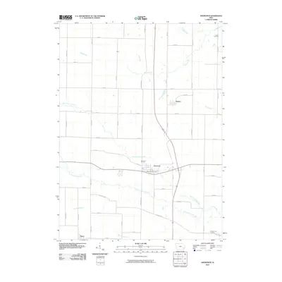
2010 Map of Ainsworth
USGS Topo · Published 2010About this map
Ainsworth sits at the heart of this agricultural landscape in Washington County, anchored by the Ainsworth Post Office and the nearby Ainsworth Cemetery. The surrounding territory is defined by a grid of rural roads and the meandering paths of several waterways, including North Fork Long Creek and South Fork Long Creek. Small communities and named locales such as Haskins, Havre, and Dairy dot the countryside, reflecting the area's long-standing rural settlement patterns.
Find a feature on this map
39 named features on this map. Tap any name to fly to it.
Don’t see what you’re looking for? This feature index may not catch every label — zoom into the map to look around manually.
Map Details
Editions of this 2010 Ainsworth Map
This is the sole edition of this map. No revisions or reprints were ever made.
Other maps of this area

1958 · Davenport
USGS Topo · 1:250,000

1961 · Davenport
USGS Topo · 1:250,000

1962 · Davenport
USGS Topo · 1:250,000

1969 · Kalona
USGS Topo · 1:24,000
1969 · Riverside
USGS Topo · 1:24,000

1969 · Washington
USGS Topo · 1:24,000
1969 · Lone Tree
USGS Topo · 1:24,000

1970 · Cotter
USGS Topo · 1:24,000

1970 · Ainsworth
USGS Topo · 1:24,000

1980 · Wayland
USGS Topo · 1:24,000