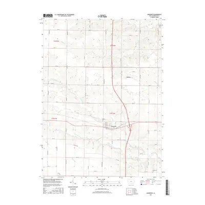
2015 Map of Ainsworth
USGS Topo · Published 2015About this map
Ainsworth sits at the junction of several primary regional arteries, including the Old White Way, a corridor that historically connected local agriculture to larger markets. This landscape in Washington County is defined by the intricate branching of the Long Creek system, where the North Fork Long Creek and South Fork Long Creek carve through the agricultural grid. These waterways, along with Whiskey Run to the north, dictate the placement of rural homesteads and cemetery sites like the Campground Cemetery and Salem Cemetery.
Find a feature on this map
52 named features on this map. Tap any name to fly to it.
Don’t see what you’re looking for? This feature index may not catch every label — zoom into the map to look around manually.
Map Details
Editions of this 2015 Ainsworth Map
This is the sole edition of this map. No revisions or reprints were ever made.
Other maps of this area

1958 · Davenport
USGS Topo · 1:250,000

1961 · Davenport
USGS Topo · 1:250,000

1962 · Davenport
USGS Topo · 1:250,000

1969 · Kalona
USGS Topo · 1:24,000
1969 · Riverside
USGS Topo · 1:24,000

1969 · Washington
USGS Topo · 1:24,000
1969 · Lone Tree
USGS Topo · 1:24,000

1970 · Cotter
USGS Topo · 1:24,000

1970 · Ainsworth
USGS Topo · 1:24,000

1980 · Wayland
USGS Topo · 1:24,000