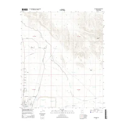
2014 Map of Ajo North
USGS Topo · Published 2014About this map
Industrial copper mining legacies define the southern landscape of this Pima County quadrangle, where the massive North Dam Tailings Pond, East Dam Tailings Pond, and South Dam Tailings Pond dominate the terrain adjacent to Gibson and the town of Ajo. The built environment is clustered along the western edge, featuring the Ajo Cem and the Eric Marcus Municipal Airport. Moving north, the settlement of Childs sits at the intersection of several desert roads and the N Ajo Well No 1 Rd. The northeastern portion of the map is dominated by the volcanic peaks of the Batamote Mountains, while the remainder of the quadrangle shows the drainage patterns of the Valley of the Ajo. Waterways such as Tenmile Wash, Sikort Chuapo Wash, and Rio Cornez carve through the arid basin, illustrating the natural hydrology of the Sonoran Desert.
Find a feature on this map
47 named features on this map. Tap any name to fly to it.
Don’t see what you’re looking for? This feature index may not catch every label — zoom into the map to look around manually.
Map Details
Editions of this 2014 Ajo North Map
This is the sole edition of this map. No revisions or reprints were ever made.
Other maps of this area

1932 · Ajo
USGS Topo · 1:62,500

1934 · Ajo
USGS Topo · 1:62,500

1953 · Ajo
USGS Topo · 1:250,000

1957 · Ajo
USGS Topo · 1:250,000

1958 · Ajo
USGS Topo · 1:250,000

1958 · Midway
USGS Topo · 1:62,500

1958 · Hat Mountain
USGS Topo · 1:62,500

1962 · Ajo
USGS Topo · 1:250,000

1963 · Ajo
USGS Topo · 1:250,000

1963 · Ajo
USGS Topo · 1:62,500