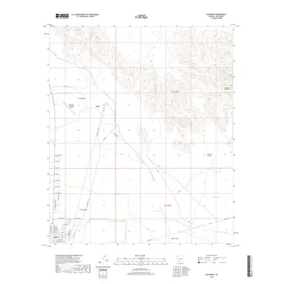
2018 Map of Ajo North
USGS Topo · Published 2018About this map
Gibson and the nearby Ajo Cem anchor the southwestern corner of this desert landscape, where human settlement meets the arid expanse of the Sonoran Desert. The map captures a transition from the structured residential grid of the town to the wide Valley of the Ajo, a terrain defined by complex drainage systems. Seasonal watercourses like Tenmile Wash, Rio Cornez, and Sikort Chuapo Wash carve paths through the alluvial flats, eventually leading toward the prominent peaks of the Batamote Mountains in the northeast.
Find a feature on this map
41 named features on this map. Tap any name to fly to it.
Don’t see what you’re looking for? This feature index may not catch every label — zoom into the map to look around manually.
Map Details
Editions of this 2018 Ajo North Map
This is the sole edition of this map. No revisions or reprints were ever made.
Other maps of this area

1932 · Ajo
USGS Topo · 1:62,500

1934 · Ajo
USGS Topo · 1:62,500

1953 · Ajo
USGS Topo · 1:250,000

1957 · Ajo
USGS Topo · 1:250,000

1958 · Ajo
USGS Topo · 1:250,000

1958 · Midway
USGS Topo · 1:62,500

1958 · Hat Mountain
USGS Topo · 1:62,500

1962 · Ajo
USGS Topo · 1:250,000

1963 · Ajo
USGS Topo · 1:250,000

1963 · Ajo
USGS Topo · 1:62,500