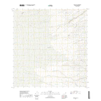
2017 Map of Akaka Falls
USGS Topo · Published 2017About this map
The dense network of streams and gulches on the windward slopes of the Island of Hawai‘i defines this landscape of dramatic elevation changes and volcanic drainage patterns. The renowned Akaka Falls sits at the heart of a hydrological system fed by the Kolekole Stream and Pahe‘ehe‘e Stream, while several other significant cataracts including Waililoa Falls and Waiahi Falls mark the steep descent toward the coast. Historical land divisions are suggested by the presence of Kaiwiki Homestead Rd and Kaieie Homestead Rd, which indicate former agricultural and residential parceling near the coast. Along the upland areas, the terrain is deeply incised by the Nāuhi Gulch and Honohina Gulch, illustrating the erosive power of the region's heavy rainfall as it moves toward the lower reaches of the Hakalau Stream and Honoli‘i Stream.
Find a feature on this map
38 named features on this map. Tap any name to fly to it.
Don’t see what you’re looking for? This feature index may not catch every label — zoom into the map to look around manually.
Map Details
Editions of this 2017 Akaka Falls Map
This is the sole edition of this map. No revisions or reprints were ever made.
Other maps of this area

1915 · Honomu
USGS Topo · 1:62,500

1917 · Hilo
USGS Topo · 1:62,500

1930 · Humuula
USGS Topo · 1:62,500

1932 · Hilo
USGS Topo · 1:62,500

1954 · Hawaii North
USGS Topo · 1:250,000

1956 · Pua Akala
USGS Topo · 1:24,000

1956 · Keanakolu
USGS Topo · 1:24,000

1956 · Upper Piihonua
USGS Topo · 1:24,000

1959 · Hawaii North
USGS Topo · 1:250,000

1961 · Hawaii North
USGS Topo · 1:250,000