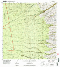
1993 Map of Akaka Falls
USGS Topo · Published 2003About this map
Akaka Falls drops dramatically within the lush terrain of the Big Island, serving as a focal point for this survey of the South and North Hilo Districts. The landscape is defined by its agricultural and residential history, specifically the system of Hawaiian homesteading. Numerous communities like Hakalau Homesteads, Honomu Homesteads, and Kaiwiki Homesteads 3 show the transition from coastal sugar lands to upland residences.
Find a feature on this map
79 named features on this map. Tap any name to fly to it.
Don’t see what you’re looking for? This feature index may not catch every label — zoom into the map to look around manually.
Map Details
Editions of this 1993 Akaka Falls Map
This is the sole edition of this map. No revisions or reprints were ever made.
Other maps of this area

1915 · Honomu
USGS Topo · 1:62,500

1917 · Hilo
USGS Topo · 1:62,500

1930 · Humuula
USGS Topo · 1:62,500

1932 · Hilo
USGS Topo · 1:62,500

1954 · Hawaii North
USGS Topo · 1:250,000

1956 · Pua Akala
USGS Topo · 1:24,000

1956 · Keanakolu
USGS Topo · 1:24,000

1956 · Upper Piihonua
USGS Topo · 1:24,000

1959 · Hawaii North
USGS Topo · 1:250,000

1961 · Hawaii North
USGS Topo · 1:250,000