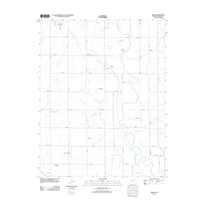
2012 Map of Akron
USGS Topo · Published 2012About this map
The Walnut River meanders through the heart of this Cowley County landscape, anchoring a rural region defined by agricultural plots and energy extraction. Small settlements like Akron and Dale are situated near the river's path, while the village of Kellogg sits at the southwestern edge of the quadrangle. For those researching local family history, the map identifies Mount Vernon Cem and Akron Cem, providing specific locations for these burial grounds.
Find a feature on this map
49 named features on this map. Tap any name to fly to it.
Don’t see what you’re looking for? This feature index may not catch every label — zoom into the map to look around manually.
Map Details
Editions of this 2012 Akron Map
This is the sole edition of this map. No revisions or reprints were ever made.
Other maps of this area

1889 · Burden
USGS Topo · 1:125,000

1890 · Wellington
USGS Topo · 1:125,000

1955 · Udall
USGS Topo · 1:24,000

1955 · Mulvane
USGS Topo · 1:24,000

1955 · Wichita
USGS Topo · 1:250,000

1958 · Wichita
USGS Topo · 1:250,000

1965 · Adamsville
USGS Topo · 1:24,000

1965 · Winfield
USGS Topo · 1:24,000
1965 · Wilmot
USGS Topo · 1:24,000
1965 · New Salem
USGS Topo · 1:24,000