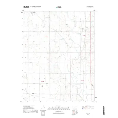
2018 Map of Akron
USGS Topo · Published 2018About this map
The Walnut River carves a winding path through this Cowley County landscape, dictating the placement of early settlements and road networks. The small community of Akron is situated near the confluence of Little Dutch Cr and the river, while the hamlet of Dale sits further west along the banks of Crooked Cr. This survey highlights the region's agricultural and transit roots, evidenced by a dense grid of section roads like 92nd Rd and Co Rd 18.
Find a feature on this map
55 named features on this map. Tap any name to fly to it.
Don’t see what you’re looking for? This feature index may not catch every label — zoom into the map to look around manually.
Map Details
Editions of this 2018 Akron Map
This is the sole edition of this map. No revisions or reprints were ever made.
Other maps of this area

1889 · Burden
USGS Topo · 1:125,000

1890 · Wellington
USGS Topo · 1:125,000

1955 · Udall
USGS Topo · 1:24,000

1955 · Mulvane
USGS Topo · 1:24,000

1955 · Wichita
USGS Topo · 1:250,000

1958 · Wichita
USGS Topo · 1:250,000

1965 · Adamsville
USGS Topo · 1:24,000

1965 · Winfield
USGS Topo · 1:24,000
1965 · Wilmot
USGS Topo · 1:24,000
1965 · New Salem
USGS Topo · 1:24,000