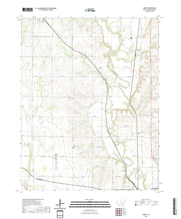
2022 Map of Akron
USGS Topo · Published 2022About this map
The Walnut River meanders southward through this section of Cowley County, anchoring a landscape defined by its agricultural grid and winding tributaries. The small settlement of Akron is situated near the river's eastern bend, while the community of Kellogg occupies the southwest, just west of Spring Cr. This area preserves several localized landmarks of interest to genealogists, including Akron Cem and Mount Vernon Cem, which serve as quiet markers of the region's rural development.
Find a feature on this map
50 named features on this map. Tap any name to fly to it.
Don’t see what you’re looking for? This feature index may not catch every label — zoom into the map to look around manually.
Map Details
Editions of this 2022 Akron Map
This is the sole edition of this map. No revisions or reprints were ever made.
Other maps of this area

1889 · Burden
USGS Topo · 1:125,000

1890 · Wellington
USGS Topo · 1:125,000

1955 · Udall
USGS Topo · 1:24,000

1955 · Mulvane
USGS Topo · 1:24,000

1955 · Wichita
USGS Topo · 1:250,000

1958 · Wichita
USGS Topo · 1:250,000

1965 · Adamsville
USGS Topo · 1:24,000

1965 · Winfield
USGS Topo · 1:24,000
1965 · Wilmot
USGS Topo · 1:24,000
1965 · New Salem
USGS Topo · 1:24,000