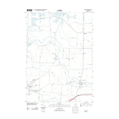
2013 Map of Akron
USGS Topo · Published 2013About this map
Akron anchors the southwestern corner of this survey, where the winding course of Murder Cr meets a grid of residential and industrial streets. To the east, the landscape opens into a web of rural roads and watercourses, most notably the meandering Tonawanda Cr and its tributaries like Ledge Cr and Whitney Cr. The distribution of burial grounds throughout the area, such as Evergreen Lawn Cem and the Long House Cem, reflects a deeply rooted settlement pattern reaching back through generations of local families. Small rural centers like Alabama, Basom, and Indian Falls serve as focal points for the surrounding agricultural lands, while the Akron Airport and proximity to Divers Lake highlight the modern mix of utility and recreation in this part of western New York.
Find a feature on this map
90 named features on this map. Tap any name to fly to it.
Don’t see what you’re looking for? This feature index may not catch every label — zoom into the map to look around manually.
Map Details
Editions of this 2013 Akron Map
This is the sole edition of this map. No revisions or reprints were ever made.
Other maps of this area

1897 · Medina
USGS Topo · 1:62,500

1897 · Lockport
USGS Topo · 1:62,500

1899 · Niagara
USGS Topo · 1:125,000

1902 · Lockport
USGS Topo · 1:62,500

1905 · Attica
USGS Topo · 1:62,500

1905 · Depew
USGS Topo · 1:62,500

1905 · Lockport
USGS Topo · 1:62,500

1944 · Alexander
USGS Topo · 1:31,680

1948 · Depew
USGS Topo · 1:62,500

1948 · Lockport
USGS Topo · 1:62,500