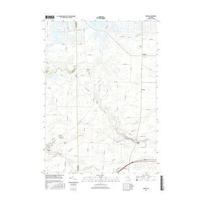
2016 Map of Akron
USGS Topo · Published 2016About this map
Oak Orchard Swamp dominates the northern reaches of this landscape where the boundaries of Niagara and Genesee counties meet. This modern survey illustrates a transition from the marshy lowlands of the north to the more developed corridors of the south, anchored by the village of Akron. The drainage patterns are defined by the winding course of Tonawanda Creek, which is crossed by the Foot Road Bridge, and the flow of Murder Creek through the southern half of the quadrangle.
Find a feature on this map
81 named features on this map. Tap any name to fly to it.
Don’t see what you’re looking for? This feature index may not catch every label — zoom into the map to look around manually.
Map Details
Editions of this 2016 Akron Map
This is the sole edition of this map. No revisions or reprints were ever made.
Other maps of this area

1897 · Medina
USGS Topo · 1:62,500

1897 · Lockport
USGS Topo · 1:62,500

1899 · Niagara
USGS Topo · 1:125,000

1902 · Lockport
USGS Topo · 1:62,500

1905 · Attica
USGS Topo · 1:62,500

1905 · Depew
USGS Topo · 1:62,500

1905 · Lockport
USGS Topo · 1:62,500

1944 · Alexander
USGS Topo · 1:31,680

1948 · Depew
USGS Topo · 1:62,500

1948 · Lockport
USGS Topo · 1:62,500