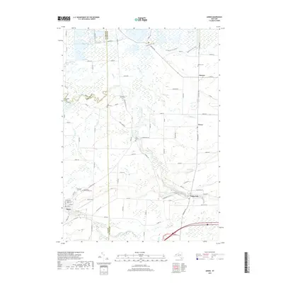
2019 Map of Akron
USGS Topo · Published 2019About this map
Tonawanda Creek meanders through this landscape at the intersection of Erie, Genesee, and Niagara counties, creating a complex network of wetlands and seasonal waterways. The village of Akron serves as the primary population center in the southwest, where the local street grid meets Murder Creek and the historical Maple Lawn Cem. To the northeast, the terrain transitions into the Oak Orchard Swamp, a significant natural feature that has historically influenced the settlement patterns of nearby Alabama and Basom. Genealogists will find several burial grounds preserved across the townships, including the Long House Cem and the Presbyterian Church Cem. The map also details local recreation and infrastructure, from the Kanyoo Nature Trail and Mohawk Ski Trail to the Akron Airport, reflecting the area's mix of rural conservation and modern utility.
Find a feature on this map
91 named features on this map. Tap any name to fly to it.
Don’t see what you’re looking for? This feature index may not catch every label — zoom into the map to look around manually.
Map Details
Editions of this 2019 Akron Map
This is the sole edition of this map. No revisions or reprints were ever made.
Other maps of this area

1897 · Medina
USGS Topo · 1:62,500

1897 · Lockport
USGS Topo · 1:62,500

1899 · Niagara
USGS Topo · 1:125,000

1902 · Lockport
USGS Topo · 1:62,500

1905 · Attica
USGS Topo · 1:62,500

1905 · Depew
USGS Topo · 1:62,500

1905 · Lockport
USGS Topo · 1:62,500

1944 · Alexander
USGS Topo · 1:31,680

1948 · Depew
USGS Topo · 1:62,500

1948 · Lockport
USGS Topo · 1:62,500