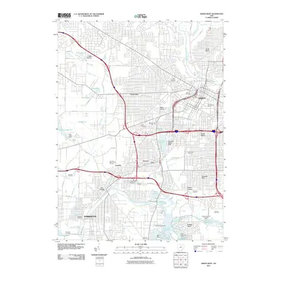
2010 Map of Akron West
USGS Topo · Published 2010About this map
The Cuyahoga River and Tuscarawas River systems converge in this detailed look at the industrial and residential landscape of Summit County. The map shows the dense urban grid of Akron and Barberton, connected by a complex network of waterways and reservoirs including Summit Lake, Lake Nesmith, and the Portage Lakes. This area represents a significant geographical divide where water begins its journey toward either Lake Erie or the Ohio River, a fact reinforced by the presence of the Feeder Race River and the Tuscarawas River Diversion Dam.
Find a feature on this map
70 named features on this map. Tap any name to fly to it.
Don’t see what you’re looking for? This feature index may not catch every label — zoom into the map to look around manually.
Map Details
Editions of this 2010 Akron West Map
This is the sole edition of this map. No revisions or reprints were ever made.
Other maps of this area

1901 · Massillon
USGS Topo · 1:62,500

1901 · Canton
USGS Topo · 1:62,500

1903 · Massillon
USGS Topo · 1:62,500

1903 · Canton
USGS Topo · 1:62,500

1903 · Akron
USGS Topo · 1:62,500

1905 · Akron
USGS Topo · 1:62,500

1906 · Kent
USGS Topo · 1:62,500

1950 · Cleveland
USGS Topo · 1:250,000

1951 · Canton
USGS Topo · 1:250,000

1953 · Canton
USGS Topo · 1:250,000