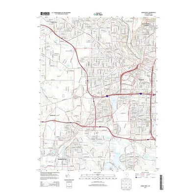
2013 Map of Akron West
USGS Topo · Published 2013About this map
Akron and its western industrial and residential corridors are captured here in the early 21st century, revealing a dense urban fabric intertwined with a complex network of glacial lakes and river systems. The transition from the high ground at Sherbondy Hill down to the water-level industrial zones is marked by landmarks like Summit Lake and the Long Lake Channel. Educational and civic life is anchored by the Univ of Akron Main Campus and the University of Akron Memorial Stadium, while the region's long memory is preserved in extensive grounds such as Glendale Cem and Greenlawn Memorial Park Cem.
Find a feature on this map
55 named features on this map. Tap any name to fly to it.
Don’t see what you’re looking for? This feature index may not catch every label — zoom into the map to look around manually.
Map Details
Editions of this 2013 Akron West Map
This is the sole edition of this map. No revisions or reprints were ever made.
Other maps of this area

1901 · Massillon
USGS Topo · 1:62,500

1901 · Canton
USGS Topo · 1:62,500

1903 · Massillon
USGS Topo · 1:62,500

1903 · Canton
USGS Topo · 1:62,500

1903 · Akron
USGS Topo · 1:62,500

1905 · Akron
USGS Topo · 1:62,500

1906 · Kent
USGS Topo · 1:62,500

1950 · Cleveland
USGS Topo · 1:250,000

1951 · Canton
USGS Topo · 1:250,000

1953 · Canton
USGS Topo · 1:250,000