2023 Map of Akron West
USGS Topo · Published 2023About this map
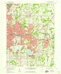
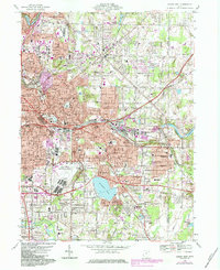
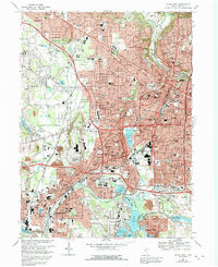
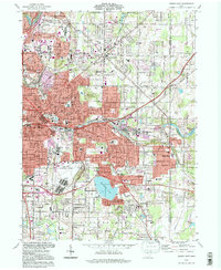
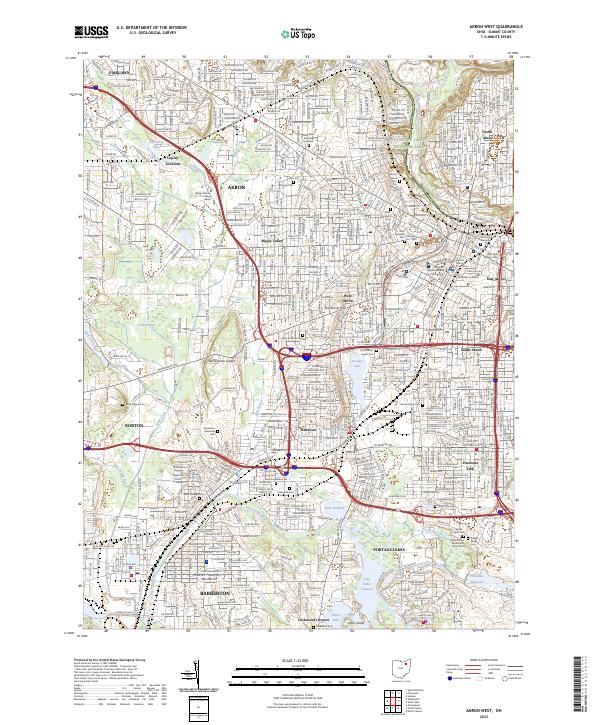
The Cuyahoga Valley National Park defines the northern reaches of this map, where the Cuyahoga River meanders toward the city. The industrial and urban heart of Akron is depicted in detail, showcasing the evolution of its residential neighborhoods like Sherbondy Hill and Kenmore alongside the Erie RR corridor. A dense concentration of historical burial sites, including the Black Plague Cemetery in Norton and the sprawling Glendale Cemetery near downtown, provides significant data for genealogists tracing early families. The landscape transitions from the dense urban grid of the University of Akron campus to the interconnected water systems of Portage Lakes and the Tuscarawas River to the south. Notable features such as Wintergreen Ledges and Summit Lake highlight the intersection of natural topography and urban development in this Summit County hub.
Find a feature on this map
69 named features on this map. Tap any name to fly to it.
Don’t see what you’re looking for? This feature index may not catch every label — zoom into the map to look around manually.
Map Details
Editions of this 2023 Akron West Map
This is the sole edition of this map. No revisions or reprints were ever made.
Historical Maps of Norton Through Time
8 maps found