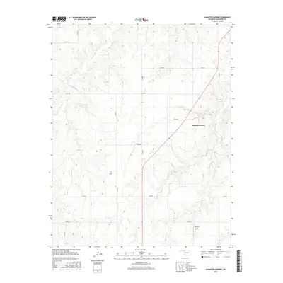
2016 Map of Alabaster Caverns
USGS Topo · Published 2016About this map
Alabaster Caverns anchors this portion of Woodward County, defining a landscape where subterranean geological features meet the drainage networks of the Great Plains. The terrain is marked by a series of significant watercourses, including Traders Cr, Girt Cr, and Slicker Cr, which carve through the Oklahoma countryside. These natural features dictated the early settlement and transportation patterns of the region, visible here through a grid of rural routes such as e0210 RD and n2150 RD.
Find a feature on this map
22 named features on this map. Tap any name to fly to it.
Don’t see what you’re looking for? This feature index may not catch every label — zoom into the map to look around manually.
Map Details
Editions of this 2016 Alabaster Caverns Map
This is the sole edition of this map. No revisions or reprints were ever made.
Other maps of this area

1955 · Woodward
USGS Topo · 1:250,000

1958 · Woodward
USGS Topo · 1:250,000

1970 · Fairvalley SW
USGS Topo · 1:24,000

1970 · Alabaster Caverns
USGS Topo · 1:24,000

1970 · Fairvalley SE
USGS Topo · 1:24,000

1970 · Fairvalley
USGS Topo · 1:24,000

1970 · Edith
USGS Topo · 1:24,000
1970 · Freedom
USGS Topo · 1:24,000

1970 · Sleeping Bear Creek SE
USGS Topo · 1:24,000

1971 · Selman SE
USGS Topo · 1:24,000