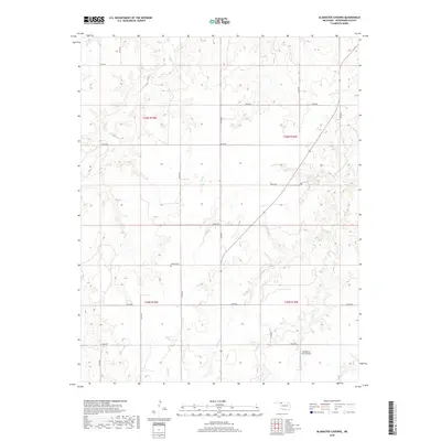
2018 Map of Alabaster Caverns
USGS Topo · Published 2018About this map
Haskew Cem sits on a high point in the northern reach of t25n r19w, overlooking a landscape carved by a series of intermittent drainages. This high plains terrain is defined by the winding paths of Traders Cr, Girl Cr, and Slicker Cr, which shape the local topography into a network of draws and ridges. In the southeast, Henderson Farm Airport reflects the integration of private aviation into the regional agricultural economy, while the township boundaries of t26n r18w and t26n r19w organize the section-line roads that crisscross the county. The map detail highlights the relationship between the natural watercourses, such as Long Cr, and the human footprint of isolated farmsteads and rural infrastructure that persists in this part of Woodward County.
Find a feature on this map
24 named features on this map. Tap any name to fly to it.
Don’t see what you’re looking for? This feature index may not catch every label — zoom into the map to look around manually.
Map Details
Editions of this 2018 Alabaster Caverns Map
This is the sole edition of this map. No revisions or reprints were ever made.
Other maps of this area

1955 · Woodward
USGS Topo · 1:250,000

1958 · Woodward
USGS Topo · 1:250,000

1970 · Fairvalley SW
USGS Topo · 1:24,000

1970 · Alabaster Caverns
USGS Topo · 1:24,000

1970 · Fairvalley SE
USGS Topo · 1:24,000

1970 · Fairvalley
USGS Topo · 1:24,000

1970 · Edith
USGS Topo · 1:24,000
1970 · Freedom
USGS Topo · 1:24,000

1970 · Sleeping Bear Creek SE
USGS Topo · 1:24,000

1971 · Selman SE
USGS Topo · 1:24,000