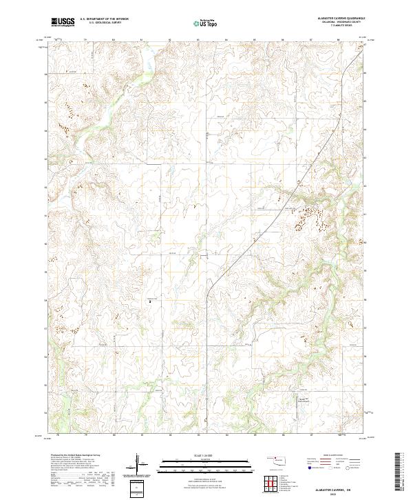
2022 Map of Alabaster Caverns
USGS Topo · Published 2022About this map
Haskew Cem sits within the section lines of Woodward County, centered in a landscape defined by the drainage patterns of Slicker Cr and Traders Cr. This portion of northwest Oklahoma retains a structured rural grid, where local transit relies on a network of numbered section roads like e0190 RD and n2125 RD. The presence of the Henderson Farm Airport in the southeastern quadrant near Long Cr highlights the continued importance of private aviation in managing these expansive agricultural tracts.
Find a feature on this map
26 named features on this map. Tap any name to fly to it.
Don’t see what you’re looking for? This feature index may not catch every label — zoom into the map to look around manually.
Map Details
Editions of this 2022 Alabaster Caverns Map
This is the sole edition of this map. No revisions or reprints were ever made.
Other maps of this area

1955 · Woodward
USGS Topo · 1:250,000

1958 · Woodward
USGS Topo · 1:250,000

1970 · Fairvalley SW
USGS Topo · 1:24,000

1970 · Alabaster Caverns
USGS Topo · 1:24,000

1970 · Fairvalley SE
USGS Topo · 1:24,000

1970 · Fairvalley
USGS Topo · 1:24,000

1970 · Edith
USGS Topo · 1:24,000
1970 · Freedom
USGS Topo · 1:24,000

1970 · Sleeping Bear Creek SE
USGS Topo · 1:24,000

1971 · Selman SE
USGS Topo · 1:24,000