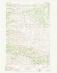
1984 Map of Aladdin
USGS Topo · Published 1984About this map
The Aladdin settlement and its surrounding resource-rich landscape are documented in this 1980s topographic study. The geography is defined by a dense network of water features including North Fork Hay Creek, Middle Fork Hay Creek, and South Fork Hay Creek, which flow through the prominent The Brakes and beneath the heights of Table Mountain and Sandstone Mountain. Evidence of early education and rural community life is visible at the Four Oaks Sch. and the Molln Ranch, while the local economy is clearly tied to the land's geology.
Find a feature on this map
25 named features on this map. Tap any name to fly to it.
Don’t see what you’re looking for? This feature index may not catch every label — zoom into the map to look around manually.
Map Details
Editions of this 1984 Aladdin Map
This is the sole edition of this map. No revisions or reprints were ever made.
Other maps of this area

1901 · Aladdin
USGS Topo · 1:125,000

1903 · Aladdin
USGS Topo · 1:125,000

1954 · The Forks
USGS Topo · 1:24,000

1954 · Gillette
USGS Topo · 1:250,000

1955 · Gillette
USGS Topo · 1:250,000

1957 · Mona
USGS Topo · 1:62,500

1957 · Colony
USGS Topo · 1:62,500

1958 · Gillette
USGS Topo · 1:250,000

1958 · Beulah
USGS Topo · 1:62,500

1962 · Gillette
USGS Topo · 1:250,000