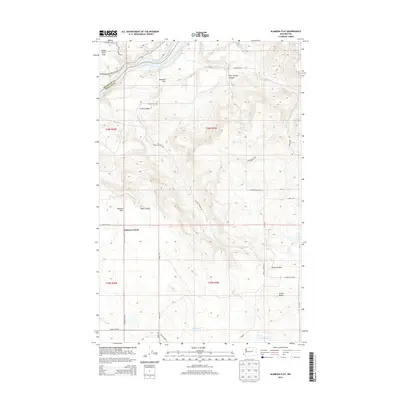
2014 Map of Alameda Flat
USGS Topo · Published 2014About this map
Osborne Corner serves as a small waypoint in this high-desert landscape, located just south of the Okanogan Co Douglas Co line. The terrain is defined by deep incisions and broad plateaus above the Columbia River, which flows through the northwestern corner of the sheet. Within the Colville Indian Reservation, the river passes over the Mah-kin Rapids near the expansive Saddle Horse Flat. The map reveals a complex network of local roads such as McIntosh NE Rd and Strahl Rex Rd that thread through the canyons, connecting remote points like Twin Springs Canyon and Buck Canyon. This 2014 survey documents the enduring physical character of the land, from the prominence of Wilson Butte in the south to the seasonal basins of Rattlesnake Lake and Wilson Lake, reflecting a region where topography dictates the flow of travel and the placement of rural outposts.
Find a feature on this map
34 named features on this map. Tap any name to fly to it.
Don’t see what you’re looking for? This feature index may not catch every label — zoom into the map to look around manually.
Map Details
Editions of this 2014 Alameda Flat Map
This is the sole edition of this map. No revisions or reprints were ever made.
Other maps of this area

1950 · Boot Mtn
USGS Topo · 1:62,500

1950 · Alameda Flat
USGS Topo · 1:62,500

1952 · Alameda Flat
USGS Topo · 1:62,500

1953 · Ritzville
USGS Topo · 1:250,000

1954 · Okanogan
USGS Topo · 1:250,000

1958 · Okanogan
USGS Topo · 1:250,000

1959 · Ritzville
USGS Topo · 1:250,000

1965 · Ritzville
USGS Topo · 1:250,000

1968 · Barker Canyon
USGS Topo · 1:24,000

1968 · Foster Coulee
USGS Topo · 1:24,000