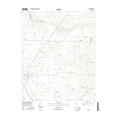
2016 Map of Alamo
USGS Topo · Published 2016About this map
Alamo serves as the central hub of this West Tennessee landscape, where the town's street grid transitions into a network of rural roads defined by agriculture and creek drainages. The Middle Fork Forked Deer River meanders across the northern portion of the quadrangle, flanked by the distinctive Horns Bluff and Mound Field. This river system and its tributaries, such as Cypress Creek and Sand Cr, have historically dictated the placement of settlements and transport routes.
Find a feature on this map
80 named features on this map. Tap any name to fly to it.
Don’t see what you’re looking for? This feature index may not catch every label — zoom into the map to look around manually.
Map Details
Editions of this 2016 Alamo Map
This is the sole edition of this map. No revisions or reprints were ever made.
Other maps of this area

1951 · Trenton
USGS Topo · 1:24,000

1956 · Blytheville
USGS Topo · 1:250,000

1959 · Blytheville
USGS Topo · 1:250,000

1959 · Bells
USGS Topo · 1:24,000

1959 · Adair
USGS Topo · 1:24,000

1959 · Humboldt
USGS Topo · 1:24,000

1961 · Jones
USGS Topo · 1:24,000
1964 · Maury City
USGS Topo · 1:24,000
1964 · Alamo
USGS Topo · 1:24,000
1964 · Brazil
USGS Topo · 1:24,000