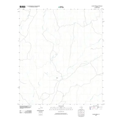
2010 Map of Alamo Spring
USGS Topo · Published 2010About this map
Ocotillo Siding stands as a primary point of interest in this arid Presidio County landscape, where transportation and intermittent waterways define the region's geography. The map reveals a complex network of ephemeral drainages that converge and diverge across the high desert terrain, including the significant runs of Alamito Creek and Cienega Creek. These watercourses, along with Alamo Creek and Black Hills Creek, illustrate the natural drainage patterns that have long dictated movement and settlement in this part of West Texas. HWY 169 provides the modern corridor through the area, following the path of least resistance through the drainage basins. The presence of Tortolo Creek in the northwest further emphasizes the rugged hydrological network that characterizes this transition between the Chihuahuan Desert and the regional highlands.
Find a feature on this map
7 named features on this map. Tap any name to fly to it.
Don’t see what you’re looking for? This feature index may not catch every label — zoom into the map to look around manually.
Map Details
Editions of this 2010 Alamo Spring Map
This is the sole edition of this map. No revisions or reprints were ever made.
Other maps of this area

1896 · Shafter
USGS Topo · 1:125,000

1959 · Presidio
USGS Topo · 1:250,000

1965 · Presidio
USGS Topo · 1:250,000

1978 · La Boquilla
USGS Topo · 1:24,000

1979 · Presidio East
USGS Topo · 1:24,000

1983 · Shafter
USGS Topo · 1:24,000

1983 · Plata
USGS Topo · 1:24,000

1983 · Cerro Redondo
USGS Topo · 1:24,000

1983 · Cienega Mountains
USGS Topo · 1:24,000
1983 · Casa Piedra
USGS Topo · 1:24,000