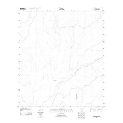
2012 Map of Alamo Spring
USGS Topo · Published 2012About this map
Big Bend Ranch State Park covers the eastern portion of this high-desert landscape in Presidio County, where a network of ephemeral drainages carves through the terrain. The hydrological life of the region is centered on vital water sources such as Chupadero Spring, Cat Spring, and the namesake Alamo Spring. These landmarks have historically dictated movement and habitation in this arid environment, providing essential stops for travelers and livestock.
Find a feature on this map
11 named features on this map. Tap any name to fly to it.
Don’t see what you’re looking for? This feature index may not catch every label — zoom into the map to look around manually.
Map Details
Editions of this 2012 Alamo Spring Map
This is the sole edition of this map. No revisions or reprints were ever made.
Other maps of this area

1896 · Shafter
USGS Topo · 1:125,000

1959 · Presidio
USGS Topo · 1:250,000

1965 · Presidio
USGS Topo · 1:250,000

1978 · La Boquilla
USGS Topo · 1:24,000

1979 · Presidio East
USGS Topo · 1:24,000

1983 · Shafter
USGS Topo · 1:24,000

1983 · Plata
USGS Topo · 1:24,000

1983 · Cerro Redondo
USGS Topo · 1:24,000

1983 · Cienega Mountains
USGS Topo · 1:24,000
1983 · Casa Piedra
USGS Topo · 1:24,000