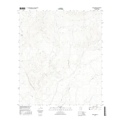
2016 Map of Alamo Spring
USGS Topo · Published 2016About this map
Alamo Spring sits at the center of this Presidio County landscape, where water sources dictate the geography of the high desert. The drainage system is defined by the convergence of several ephemeral watercourses, most notably Alamito Cr and Cienega Cr, which carve through the arid terrain. The presence of Arroyo Monias in the northwest and Black Hills Creek to the southeast illustrates a topography dominated by erosion and runoff channels typical of the Trans-Pecos region. Transportation across this sparse environment is facilitated by Casa Piedra Rd and Hwy 169, which follow the natural contours of the land. This survey from the U.S. Geological Survey captures the modern state of these remote corridors and vital water points, providing essential data for those studying the hydrology and ranching infrastructure of West Texas.
Find a feature on this map
8 named features on this map. Tap any name to fly to it.
Don’t see what you’re looking for? This feature index may not catch every label — zoom into the map to look around manually.
Map Details
Editions of this 2016 Alamo Spring Map
This is the sole edition of this map. No revisions or reprints were ever made.
Other maps of this area

1896 · Shafter
USGS Topo · 1:125,000

1959 · Presidio
USGS Topo · 1:250,000

1965 · Presidio
USGS Topo · 1:250,000

1978 · La Boquilla
USGS Topo · 1:24,000

1979 · Presidio East
USGS Topo · 1:24,000

1983 · Shafter
USGS Topo · 1:24,000

1983 · Plata
USGS Topo · 1:24,000

1983 · Cerro Redondo
USGS Topo · 1:24,000

1983 · Cienega Mountains
USGS Topo · 1:24,000
1983 · Casa Piedra
USGS Topo · 1:24,000