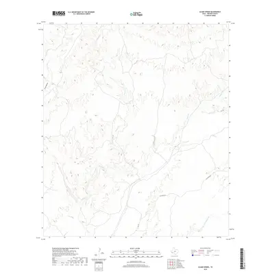
2019 Map of Alamo Spring
USGS Topo · Published 2019About this map
Alamito Cr serves as a central drainage through this Presidio County landscape, where an intricate network of intermittent waterways carves through the high desert terrain. The convergence of Cienega Cr with larger systems illustrates the complex hydrology of the Big Bend region, where seasonal water flow dictates the geography. Surface transportation is defined by the winding path of Hwy 169 and the intersection with Casa Piedra Rd, routes that follow the natural contours of the land to connect remote ranchlands and homesteads. Further east, Alamo Cr and Black Hills Creek mark the transition toward more varied elevations, while Arroyo Monias and Tortolo Cr trace the western boundary of this drainage basin. This 2019 survey by the U.S. Geological Survey documents the enduring rural character of West Texas, where land use remains tied to these vital watercourses.
Find a feature on this map
8 named features on this map. Tap any name to fly to it.
Don’t see what you’re looking for? This feature index may not catch every label — zoom into the map to look around manually.
Map Details
Editions of this 2019 Alamo Spring Map
This is the sole edition of this map. No revisions or reprints were ever made.
Other maps of this area

1896 · Shafter
USGS Topo · 1:125,000

1959 · Presidio
USGS Topo · 1:250,000

1965 · Presidio
USGS Topo · 1:250,000

1978 · La Boquilla
USGS Topo · 1:24,000

1979 · Presidio East
USGS Topo · 1:24,000

1983 · Shafter
USGS Topo · 1:24,000

1983 · Plata
USGS Topo · 1:24,000

1983 · Cerro Redondo
USGS Topo · 1:24,000

1983 · Cienega Mountains
USGS Topo · 1:24,000
1983 · Casa Piedra
USGS Topo · 1:24,000