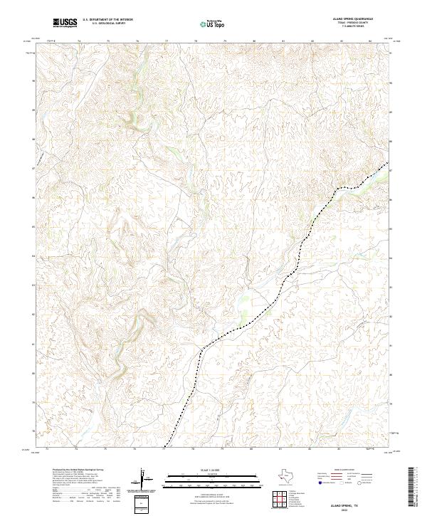
2022 Map of Alamo Spring
USGS Topo · Published 2022About this map
Arid drainage networks define the landscape of the Presidio county backcountry, where the intermittent flow of Alamito Cr serves as a primary topographic anchor. This 2022 survey documents the sparse infrastructure of the Big Bend region, centered on the intersection of Hwy 169 and Casa Piedra Rd. The map illustrates a complex system of dry washes and canyons, including Cienega Cr and Black Hills Creek, which illustrate the natural erosion patterns typical of the Trans-Pecos desert. Smaller features like Arroyo Monias and Tortolo Cr further detail the local hydrology. This modern study provides an essential record of the contemporary road network and drainage basins in a region where natural watercourses have historically dictated settlement and transit routes.
Find a feature on this map
7 named features on this map. Tap any name to fly to it.
Don’t see what you’re looking for? This feature index may not catch every label — zoom into the map to look around manually.
Map Details
Editions of this 2022 Alamo Spring Map
This is the sole edition of this map. No revisions or reprints were ever made.
Other maps of this area

1896 · Shafter
USGS Topo · 1:125,000

1959 · Presidio
USGS Topo · 1:250,000

1965 · Presidio
USGS Topo · 1:250,000

1978 · La Boquilla
USGS Topo · 1:24,000

1979 · Presidio East
USGS Topo · 1:24,000

1983 · Shafter
USGS Topo · 1:24,000

1983 · Plata
USGS Topo · 1:24,000

1983 · Cerro Redondo
USGS Topo · 1:24,000

1983 · Cienega Mountains
USGS Topo · 1:24,000
1983 · Casa Piedra
USGS Topo · 1:24,000