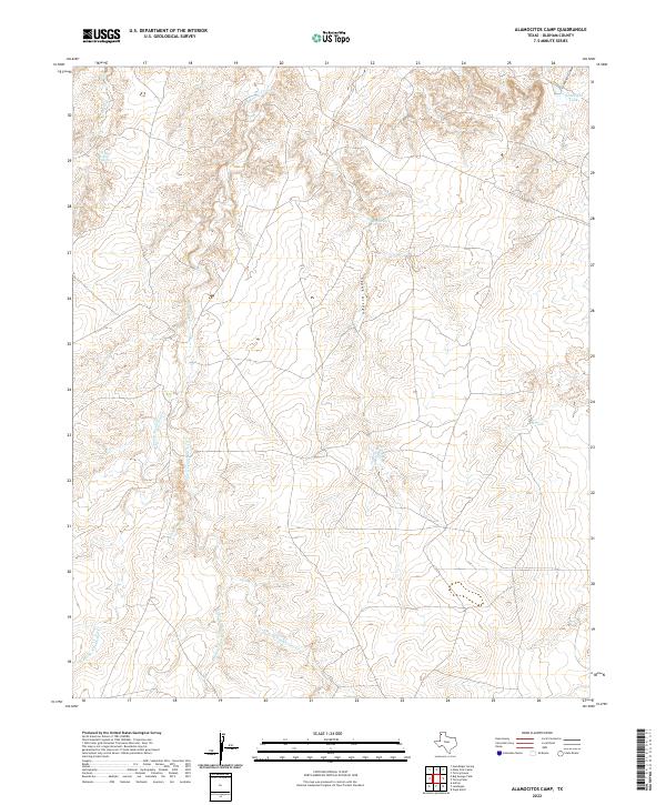
2022 Map of Alamocitos Camp
USGS Topo · Published 2022About this map
Alamocitos Cr and its various branches dominate this high plains landscape in Oldham County, illustrating a complex drainage system essential for cattle ranching. The presence of Goodnight Canyon and the Goodnight Tank in the northeast corner of the map marks the legacy of the historic Goodnight-Loving ranching interests that shaped the Texas Panhandle. Several vital water sources are mapped here, including the Big Spring and Skunk Arroyo Spring, which provided reliable water in a semi-arid environment. The branching tributaries of E Prong Alamocitos Cr, Middle Prong Alamocitos Cr, and W Prong Alamocitos Cr converge to form a network of seasonal watercourses and arroyos. This survey provides a clear view of the ranching infrastructure through isolated features like JS Tank and the small springs that dot the terrain.
Find a feature on this map
13 named features on this map. Tap any name to fly to it.
Don’t see what you’re looking for? This feature index may not catch every label — zoom into the map to look around manually.
Map Details
Editions of this 2022 Alamocitos Camp Map
This is the sole edition of this map. No revisions or reprints were ever made.
Other maps of this area

1954 · Tucumcari
USGS Topo · 1:250,000

1958 · Tucumcari
USGS Topo · 1:250,000

1966 · Alamocitos Camp
USGS Topo · 1:24,000

1966 · Adrian
USGS Topo · 1:24,000

1966 · Big George Tank
USGS Topo · 1:24,000

1966 · Landergin
USGS Topo · 1:24,000

1966 · Torrea Peak
USGS Topo · 1:24,000
1966 · Vega North
USGS Topo · 1:24,000

1971 · Many Post Camp
USGS Topo · 1:24,000
1971 · Torrey House
USGS Topo · 1:24,000