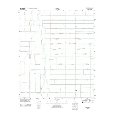
2012 Map of Alamorio
USGS Topo · Published 2012About this map
The Alamo River snakes through a heavily engineered agricultural landscape in the Imperial Valley during the early 21st century. This region is defined by a dense, rectilinear grid of irrigation and drainage infrastructure essential for desert farming, including the Holtville Main Drain and numerous specialized channels like Oak Lateral and O Rita Lateral. These waterworks facilitate the cultivation of the surrounding fields, supporting small clusters and named settlements such as Alamorio, Orita, Curlew, and Sandia. The map illustrates a highly organized rural economy where the natural path of the river is closely bounded by man-made conduits like the Moss Drain. Regional transit is anchored by the E Ben Hulse Hwy, which cuts across the northern reaches, connecting these agrarian outposts.
Find a feature on this map
118 named features on this map. Tap any name to fly to it.
Don’t see what you’re looking for? This feature index may not catch every label — zoom into the map to look around manually.
Map Details
Editions of this 2012 Alamorio Map
This is the sole edition of this map. No revisions or reprints were ever made.
Other maps of this area

1907 · Holtville
USGS Topo · 1:125,000

1915 · El Centro
USGS Topo · 1:125,000

1940 · Brawley
USGS Topo · 1:62,500

1940 · Iris
USGS Topo · 1:62,500

1940 · Alamorio
USGS Topo · 1:62,500

1942 · El Centro
USGS Topo · 1:250,000

1943 · Brawley
USGS Topo · 1:62,500

1944 · Calipatria
USGS Topo · 1:62,500

1945 · Alamorio
USGS Topo · 1:62,500

1945 · Iris
USGS Topo · 1:62,500