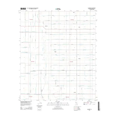
2015 Map of Alamorio
USGS Topo · Published 2015About this map
The Alamo River winds through this section of the Imperial Valley, where a complex grid of irrigation infrastructure defines the landscape. The map reveals an intensive network of water management, with features like the Moorhead Canal and numerous distribution channels such as Moss Lateral, Orita Lateral, and Oleander Lateral. These engineered waterways serve a series of small agricultural settlements including Alamorio, Moss, Orita, and Curlew. This intricate system of laterals and drains, including the Wills Drain and Osage Drain, illustrates the 21st-century transformation of the desert into productive farmland. For researchers, the map provides precise locations for these water-dependent communities and the rectilinear road network, including O'Brien Rd and Taecker Rd, that connects the various farmsteads and rural junctions.
Find a feature on this map
120 named features on this map. Tap any name to fly to it.
Don’t see what you’re looking for? This feature index may not catch every label — zoom into the map to look around manually.
Map Details
Editions of this 2015 Alamorio Map
This is the sole edition of this map. No revisions or reprints were ever made.
Other maps of this area

1907 · Holtville
USGS Topo · 1:125,000

1915 · El Centro
USGS Topo · 1:125,000

1940 · Brawley
USGS Topo · 1:62,500

1940 · Iris
USGS Topo · 1:62,500

1940 · Alamorio
USGS Topo · 1:62,500

1942 · El Centro
USGS Topo · 1:250,000

1943 · Brawley
USGS Topo · 1:62,500

1944 · Calipatria
USGS Topo · 1:62,500

1945 · Alamorio
USGS Topo · 1:62,500

1945 · Iris
USGS Topo · 1:62,500