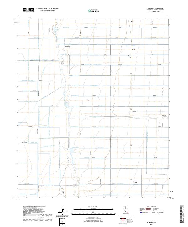
2021 Map of Alamorio
USGS Topo · Published 2021About this map
The Imperial Valley landscape is defined by an intricate network of irrigation channels and drainage ditches that support this agricultural powerhouse. The Alamo River snakes through the center of the sheet, surrounded by a geometric grid of laterals and drains named after plants and geographic markers, such as the Oak Lateral, Osage Lateral, and Orchid Lateral. Small settlements and junction points including Alamorio, Orita, and Sandia serve as the primary human hubs within this highly engineered environment. The infrastructure is anchored by major works like the Holtville Main Drain, which manage water flow across the desert floor. This grid-heavy layout reveals the intensive land management required to sustain farming in the region, with roads like Silliman Rd and Taecker Rd following the water lines to connect the scattered communities of Curlew and Moss to the wider valley.
Find a feature on this map
123 named features on this map. Tap any name to fly to it.
Don’t see what you’re looking for? This feature index may not catch every label — zoom into the map to look around manually.
Map Details
Editions of this 2021 Alamorio Map
This is the sole edition of this map. No revisions or reprints were ever made.
Other maps of this area

1907 · Holtville
USGS Topo · 1:125,000

1915 · El Centro
USGS Topo · 1:125,000

1940 · Brawley
USGS Topo · 1:62,500

1940 · Iris
USGS Topo · 1:62,500

1940 · Alamorio
USGS Topo · 1:62,500

1942 · El Centro
USGS Topo · 1:250,000

1943 · Brawley
USGS Topo · 1:62,500

1944 · Calipatria
USGS Topo · 1:62,500

1945 · Alamorio
USGS Topo · 1:62,500

1945 · Iris
USGS Topo · 1:62,500