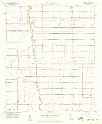
1956 Map of Alamorio
USGS Topo · Published 1958About this map
The Alamo River defines the western edge of this agricultural landscape in Imperial County, where an intricate lattice of drainage and irrigation infrastructure supports the desert valley's reclamation. In the mid-1950s, the engineering of the land is primary, seen in the proliferation of features like the Moorhead Canal, Rockwood Canal, and numerous numbered laterals and drains that feed the grid. Small settlements and sidings such as Alamorio, Orita, and Sandia are situated along the transit corridor of the Pacific Southern railroad, serving as collection points for the region's produce. Educational hubs like Magnolia Union Sch, Rose Mesquite School, and Pine Union School are spaced across the map, reflecting the distributed rural population of the era. The presence of Grain Tanks and a Reservoir underscores the industrial-scale coordination of water and grain storage essential for the valley's economy.
Find a feature on this map
62 named features on this map. Tap any name to fly to it.
Don’t see what you’re looking for? This feature index may not catch every label — zoom into the map to look around manually.
Map Details
Editions of this 1956 Alamorio Map
3 editions found
Other maps of this area

1907 · Holtville
USGS Topo · 1:125,000

1915 · El Centro
USGS Topo · 1:125,000

1940 · Brawley
USGS Topo · 1:62,500

1940 · Iris
USGS Topo · 1:62,500

1940 · Alamorio
USGS Topo · 1:62,500

1942 · El Centro
USGS Topo · 1:250,000

1943 · Brawley
USGS Topo · 1:62,500

1944 · Calipatria
USGS Topo · 1:62,500

1945 · Alamorio
USGS Topo · 1:62,500

1945 · Iris
USGS Topo · 1:62,500